3 February
Daily volcano update
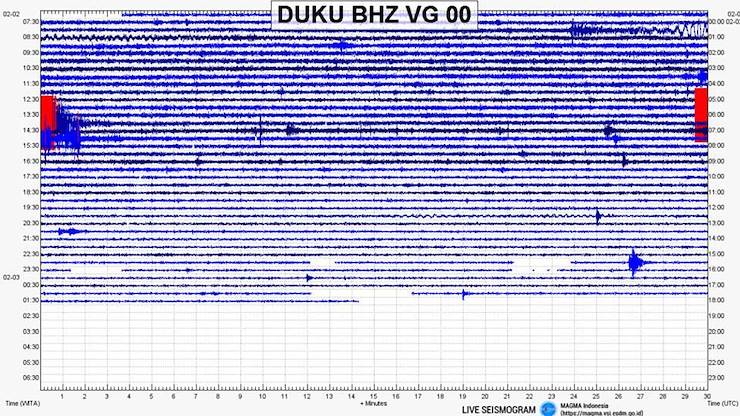
Yesterday was marked by good-sized tectonic earthquakes around Bali, starting with the 4.3 earthquake of the northeast coast of Lombok at 06:02 (noted in yesterday’s update), and followed by a 4.8 earthquake at 13:59 closer to home in the straits between Bali and Lombok (see photo). Did this generate (or contribute to) the good, long, blowing tremor that started just before 15:00? Maybe, maybe not, but it’s the biggest blower we’ve had in a while, and I tend to think it’s a good thing when Agung releases some of that pressure inside. PVMBG has been having some trouble with the live seismograph lines – yesterday it affected all seismographs, but this morning it’s just Agung.
BPBD’s report yesterday on evacuees: 185 evacuation posts (same as the previous day) counted 22,810 evacuees registered (-213). Roughly 17,000 people are estimated to reside in the 6 km exclusion zone.
Darwin VAAC does not show Agung on the map, nor does FlightRadar24 (which imports the data from the VAAC) – no airborne ash can be identified. Windy.com shows today’s air currents to the East from the surface to 5,500 meters (up to the top of the most recent ash columns) (same as the past week). Airport operations are currently normal.